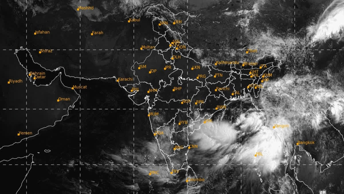
Kolkata (West Bengal): A deep depression over the Bay of Bengal is gradually gaining strength and is likely to concentrate into a cyclonic storm and then into a severe cyclonic storm, Remal, by late Saturday night, officials at the Regional Meteorological Centre in Kolkata said.
Cyclone Remal, in all likelihood, will gain more strength and make landfall on the night of May 26 near the Sunderbans, in between Sagar Islands of West Bengal and Khepupara in Bangladesh with wind speeds ranging between 110 to 120 km per hour, and with gusting of above 135 kmph, Met officials said.
The Kolkata Met Office has issued a 'Red alert' for the districts of North 24 Parganas and South 24 Parganas of West Bengal and a warning of extremely heavy rainfall in Kolkata and adjoining areas, including the coastal district of Purba Medinipur all through May 26 and 27.
Extreme heavy precipitation of over 200 mm may hit Kolkata, Howrah, Hooghly, Nadia and Purba Medinipur as well as northern Odisha and parts of the Northeast throughout May 26 and 27 due to the effects of cyclone Remal, the Met office said adding, around 100 mm of rains are expected to drench the districts of Paschim Medinipur and Purba Bardhaman of West Bengal, as well.
Director at the Regional Meteorological Centre, Kolkata, Somnath Dutta said, "Storm surge of up to 1.5 metres high is expected to hit low-lying areas of coastal West Bengal. There is a high possibility of inundation in low-lying areas at the time of the cyclonic storm's landfall. Fishermen have been strictly warned not to venture into the sea around the north of the Bay of Bengal till May 27. We will keep updating about the situation as it evolves."
This is the first cyclone in the Bay of Bengal this pre-monsoon season and the name Remal is been given by Oman, which loosely translates to sand.
The Indian Meteorological Department (IMD) has warned of extensive damage to power and communication lines, standing crops, vulnerable structures and non-metalled roads across North and South 24 Parganas districts. The Met Office has also warned of unattached metal sheets flying off from structures, breaking of tree branches, uprooting of trees with major damage to banana and papaya trees, and dead limbs blowing off from trees.
The Eastern Railways has suspended all suburban train services along its Sealdah South section and Barasat-Hasnabad route from 11 PM of May 26 to 6 AM of May 27 as a precautionary measure. The Railways has already put all departments on extremely high alert, especially those under the Sealdah Division, where the railway network stretches deep into the districts of North and South 24 Parganas.
"All officials and engineers have been asked to report to duty from today, May 25 to May 27 and have been asked to be on high alert. To combat any eventuality and snapping of electrical overhead power lines, diesel-run locomotives have been kept on standby at Sealdah, DumDum, Barasat, Naihati, Ranaghat and other key stations," said a senior official of Sealdah Division.
Vulnerable structures and billboards fixed in and around stations are being checked and if found unstable, will be removed, the official said.


