ETV Bharat / state

Cyclone Fani: IMD issues 'yellow warning' in Odisha

author img

By

Published : May 1, 2019, 9:15 AM IST

Updated : May 1, 2019, 12:17 PM IST

IMD has issued 'yellow warning' in Odisha

A 'yellow warning' has been issued for Odisha coast on Tuesday by the Indian Meteorological Department (IMD) predicting heavy to very heavy rainfall at isolated places such as Boudh, Kalahandi, Sambalpur, Deogarh, and Sundargarh. IMD has advised total suspension of fishing operations, extensive evacuation from coastal areas, diversion or suspension of rail and road traffic, no movement in motor boats and small ships and people in affected areas to remain indoors.

Bhubaneswar: The Indian Meteorological Department (IMD) on Tuesday issued a 'yellow warning' for Odisha coast predicting heavy to very heavy rainfall at isolated places such as Boudh, Kalahandi, Sambalpur, Deogarh, and Sundargarh.

"Heavy to very heavy rainfall at isolated places the districts of Boudh, Kalahandi Sambalpur Deogarh and Sundargarh of Odisha," said the IMD.

IMD issues 'yellow warning' in Odisha

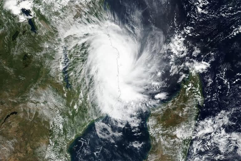
As per the disaster management division of the Ministry of Home Affairs, Cyclone Fani is very likely to move northwestwards on till May 1 noon and thereafter recurve north-northeastwards and cross Odisha Coast between Gopalpur and Chandbali. From there, it will move to the south of Puri around May 3 afternoon with maximum sustained wind of speed 175-185 kmph gusting to 205 kmph.

Gale wind with speed 150 -160 kmph gusting to 170 is also likely over the districts of Ganjam, Puri, Jagatsinghpur, Kendrapara, 110-120 kmph gusting to 130 kmph is also likely over the districts of Gajapati, Khurda, Cuttack, Jajpur, Bhadrak, Balasore, 80-90 kmph over the districts of Nayagarh, Angul, Keonjhar, Mayurbhanj, Dhenkanal and squally wind speed 30-40 kmph gust to 50 kmph over the rest districts of Odisha by the evening of May 3, the IMD said.

The sea conditions are very likely to be rough to very rough along and off Odisha Coast on May 2 a nd become high to phenomenal by May 4. Fishermen have been advised not to venture into deep sea areas of northwest and adjoining West-central Bay of Bengal along and off Odisha coast from May 2 to May 4.

The expected damage due to Cyclone Fani includes -- extensive damage to all types of kutcha houses, extensive uprooting of communication and power poles, disruption of rail and road link at several places, extensive damage to standing crops, plantations, orchards, blowing down of Palm and coconut trees, uprooting of large bushy trees and large boats and ships may get torn from their moorings.

In order to prevent such damage, IMD has advised total suspension of fishing operations, extensive evacuation from coastal areas, diversion or suspension of rail and road traffic, no movement in motor boats and small ships and people in affected areas to remain indoors.

Also Read: Ammonia gas leaked in oil mill, no casualties reported

Intro:Body:

Cyclone Fani: IMD issues 'yellow warning' in Odisha


Bhubaneswar: The Indian Meteorological Department (IMD) on Tuesday issued a 'yellow warning' for Odisha coast predicting heavy to very heavy rainfall at isolated places such as Boudh, Kalahandi, Sambalpur, Deogarh, and Sundargarh.


"Heavy to very heavy rainfall at isolated places the districts of Boudh, Kalahandi Sambalpur Deogarh and Sundargarh of Odisha," said the IMD.


As per the disaster management division of the Ministry of Home Affairs, Cyclone Fani is very likely to move northwestwards on till May 1 noon and thereafter recurve north-northeastwards and cross Odisha Coast between Gopalpur and Chandbali. From there, it will move to the south of Puri around May 3 afternoon with maximum sustained wind of speed 175-185 kmph gusting to 205 kmph.


Gale wind with speed 150 -160 kmph gusting to 170 is also likely over the districts of Ganjam, Puri, Jagatsinghpur, Kendrapara, 110-120 kmph gusting to 130 kmph is also likely over the districts of Gajapati, Khurda, Cuttack, Jajpur, Bhadrak, Balasore, 80-90 kmph over the districts of Nayagarh, Angul, Keonjhar, Mayurbhanj, Dhenkanal and squally wind speed 30-40 kmph gust to 50 kmph over the rest districts of Odisha by the evening of May 3, the IMD said.


The sea conditions are very likely to be rough to very rough along and off Odisha Coast on May 2 and become high to phenomenal by May 4. Fishermen have been advised not to venture into deep sea areas of northwest and adjoining West-central Bay of Bengal along and off Odisha coast from May 2 to May 4. 


The expected damage due to Cyclone Fani includes -- extensive damage to all types of kutcha houses, extensive uprooting of communication and power poles, disruption of rail and road link at several places, extensive damage to standing crops, plantations, orchards, blowing down of Palm and coconut trees, uprooting of large bushy trees and large boats and ships may get torn from their moorings.


In order to prevent such damage, IMD has advised total suspension of fishing operations, extensive evacuation from coastal areas, diversion or suspension of rail and road traffic, no movement in motor boats and small ships and people in affected areas to remain indoors.


Conclusion:
Last Updated :May 1, 2019, 12:17 PM IST
ETV Bharat Logo

Copyright © 2024 Ushodaya Enterprises Pvt. Ltd., All Rights Reserved.