Chennai (Tamil Nadu): In the heart of Chennai, the fears of cyclones and their landfall loom large every November, keeping people in the cultural capital of South India on their toes.
Scientists in the region have their work cut out, alarming the residents about tsunamis and storms. But wow do they predict these natural hazards? ETV Bharat reached out to the scientists at the National Institute of Ocean Technology (NIOT) at Pallikaranai, Chennai to know about the science behind it.
The institute, operating under the aegis of the Ministry of Earth Sciences, primarily researches on oceans and monitors weather, geological changes, storms, tsunamis, among other natural hazards.
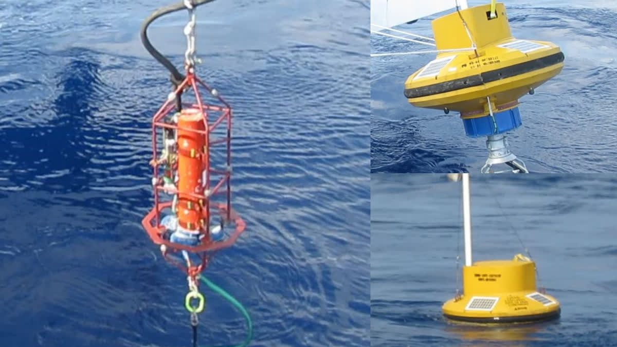
Established in 1996, the National Data Buoy Program plays a pivotal role in this endeavour. Its primary objective is to install anchored monitoring systems, known as data buoys, in the Indian Ocean, and acquire and maintain their information. These data buoys are equipped with sensors that monitor changes in weather and ocean.
M. Arul Muthiah, Scientist in charge of Ocean Observations of the National Institute of Ocean Technology, in an exclusive interview to ETV Bharat said these data buoys are installed in 15 locations.
"Since 1997, we have been installing data buoys in the Indian Ocean and Arabian Sea region and receiving data. These facilities are located at 12 locations in the deep sea and 3 offshore locations in the Arabian Sea and Bay of Bengal," he said.
Seven tsunami detection machines have been installed, of which five are stationed in the Bay of Bengal and two are stationed and monitored in the Arabian Sea, he said. Muthiah said the information provided by these machines is received and sent to the Indian National Centre for Ocean Information Services, which further relays the information to the Meteorological Centre and other departments.
Further explaining the process, the NIOT Scientist said that satellites are the only means by which deep-sea instruments can exchange information with the shore-based control centre, and information from these instruments is transmitted to the satellites every three hours.
"Two batteries are installed for the uninterrupted operation of these devices at sea. One of these is generating electricity from sunlight," he said. Muthiah said in case the solar batteries stop working, the lithium-ion battery automatically starts functioning.
Sensors on these data buoys can detect changes in deep ocean currents and provide crucial early warning if a tsunami is imminent. Instruments that sense ground vibrations are installed at a depth of about 4,000 meters in deep sea. These instruments continue to provide data even after a tsunami occurs. With this, scientists can predict the area where a tsunami is going to occur and the extent of the impact.
Arul Muthiah also pointed out that before 2004, there were no tsunami-warning devices in India. Buoys have been installed to specifically cover areas that have been hit by storms in the past and are prone to them. The buoys record crucial data upon the formation of low-pressure systems, which often precede storm formation.
Storm formation dynamics, including wind speed and sea surface temperature, play pivotal roles in the prediction process. By monitoring sea surface temperatures, the buoy system effectively detects fluctuations in thermal pressure within the ocean, with temperatures potentially reaching up to 26 degrees Celsius prior to a storm. This data enables precise forecasting and timely dissemination of warning information, harnessing technology to enhance disaster preparedness and safeguard communities, the NIOT scientist said.
Beyond natural hazards, scientists also encounter some man-made disturbances. The presence of buoys often leads to an abundance of fish population, attracting fishing activities. However, the nets cast to catch fish are sometimes broken by buoys. The fishermen, in reply, often damage the buoys, necessitating premature replacements. Muthiah emphasised on the need for fishermen to refrain from such practices to ensure the sustained functionality of monitoring systems crucial for both safety and ecological preservation.
International collaboration plays a pivotal role in enhancing early warning systems for tsunamis and storms. Countries worldwide cooperate to facilitate the seamless exchange of vital information, bolstering global resilience against natural disasters. Moreover, concerted efforts since 2014 have focused on the development of autonomous monitoring technologies, including robotic coastal monitoring systems and robotic fish, through partnerships with institutions such as the Arctic and Ocean Research Centre.
Read More


